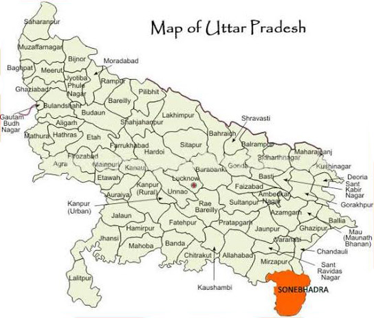
| Uttar Pradesh PROFILE | |
| ADMINISTRATIVE SETUP | |
| Area | 243,286 km |
| Districts | 75 |
| Blocks | 822 |
| Tahasils | 350 |
| Villages | 97,941 |
| Gram Panchyats | 59163 |
| Rural/Urban Ratio | 22.27/ 77.73 |
| DEMOGRAPHY | |
| Population | 199812341 |
| Sex Ratio | 912 |
| Children (age 0 to 6 years) | 30791331 |
| Average Family Size | 5.7 |
| No of Anganwadi’s Centre / Mini AWC’s | 188259/10216 |
| No of Primary Health Centres / Sub centres | 3496/771 |
| Infant Mortality Rate Per 1000 | 41 |
| Maternal Materiality rate Per 100000 | 201 |
| Literacy | 69.72 |
| Forest Cover | 14806 sq.km |
| Industrial Units | Steel, Aluminium & Power Plants. Mining. |
| Irrigated Area | |
| Affected by Left Wing Extremism | YES, Low |
| MGNREGA DATA (2019-20) | |
| No. of Families who got work | 9747 |
| Average No. of Days | 41.80 |
Source
Forest Survey 2019-20
MGNREGA
