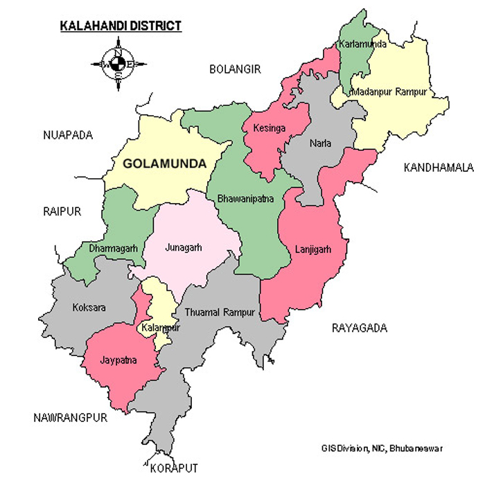
Areas of Operation in Kalahandi District
State: Odisha
District: Kalahandi
Peoples Organisation (Nagrik Vikas Sangathan)
Kalahandi District Map

| KALAHANDI DISTRICT PROFILE | |
| ADMINISTRATIVE SETUP | |
| Area | 7920 sq.km |
| Blocks | 13 |
| Gram Panchayats | 310 |
| Villages | 2,247 |
| Rural/Urban Ratio | 92.26/7.74 |
| DEMOGRAPHY | |
| Population | 1,576,869 |
| Sex Ratio | 1,003 |
| Children (age 0 to 6 years) | 2,22,570 |
| Average Family Size | 5 persons |
| No of Aganwadi’s Centre / Mini AWC’s | |
| No of Primary Health Centers / Sub centers | 43/1 |
| Infant Mortality Rate | 59 |
| Maternal Materiality rate | 30 |
| Literacy | 59.22 |
| ECONOMY | |
| HDI | 0.12 |
| GDP | |
| Per capita Income Rs | |
| Forest Cover | 2538.01 sq.km |
| Industrial Units | Bauxite, Graphites, Manganese, Iron and Quartz |
| Irrigated Area | 198462 hect |
| Affected by Left Wing Extremism | Yes, medium |
| MGNREGA DATA (2020-21) | |
| No. of Families who got work | 52094 |
| Average No. of Days | 51.33 |
