Odisha
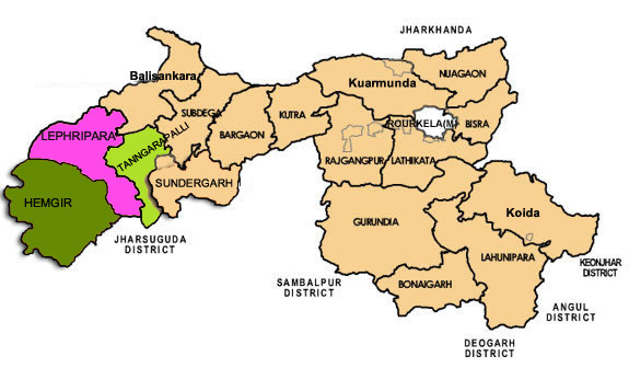
Areas of Operation in Sundergarh District
District Profile
Sundargarh district was constituted on the 1st January, 1948 out of the two ex-states of Gangpur and Bonai, which merged with Odisha on that day. With over 40% forest cover and a majority tribal population this “beautiful” lives up to its name. Geographically the district is not a compact unit and consists to widely dissimilar tracts of expansive and fairly open country dotted with tree-clad isolated peaks, vast inaccessible forests, and extensive river valleys and mountains terrain. Broadly speaking, it is an undulating tableland of different elevations broken up by rugged hill ranges and cut up by torrential hill streams and the river IB and Brahmani.There are substantial mineral deposits in the forest areas and rourkela is home to one of India’s oldest integrated state owned steel plants. However its proximity to Jharkhand State has led to considerable left wing extremist activities in the border regions.
Atmashakti Intervention: August2009
We have ten jansathi’s working in Hemgir, Lephripara and Tangarpali blocks.
| ADMINISTRATIVE SETUP | |
| Area | 9,712 sq km |
| Blocks | 17 |
| Panchayats | 279 |
| Villages | 1,779 |
| Rural/Urban Ratio | 69.76/30.24 |
| DEMOGRAPHY | |
| Population | 20,93,437 |
| Sex Ratio (females 1000 per males) | 973 |
| Children (0 – 6 years) | 2,63,160 |
| Average Family Size | 5 |
| No of Aganwadis Centers/ Mini AWC’s | 2922/783 |
| No of Primary Health Centers/ Sub Centre | 61/308 |
| Infant Mortality Rate | 62 |
| Maternal Mortality Rate | 39 |
| Literacy | 73.34 |
| ECONOMY | |
| HDI | 0.683 |
| GDP | |
| Percapita Income Rs | 6,823 |
| Per capita-state | 5,264 |
| Forest Cover | 4,232.57 sq km |
| Industrial units | Rourkela, Steel Plant & mining |
| Irrigated Area | 1,78,410 ha |
| Affected by Left Wing Extremism | YES, High |
| MGNREGA DATA (2020-21) | |
| No. of Families who got work | 22326 |
| Average No. of Days | 66.14 |