Areas of Operation in Nayagarh District
State: Odisha
District: Nayagarh
Peoples’ Organisation (Jan Sangathan)
Mahila Jeebika Suraksha Manch(MJSM)
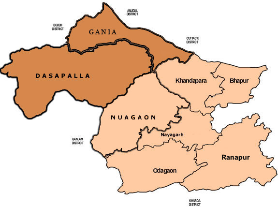
Nayagarh District Map
Distirct Profile
Nayagarh district is situated on the hilly ranges in the west and its north eastern parts have formed small well cutivated fertile valleys intersected by small streams. Summers extremely hot and the winters quite cold. The district celebrates many fairs and festivals around the year. Ravanpodi at Daspalla, Pana Sanakranti of Dakhinakali at Nayagarh, Shivratri of Sri Ladubaba at Sarankul, Magha Saptami at Kantilo, Ram Navami at Odagaon, Car Festival at Nayagarh. The languages spoken in the district is Oriya,Hindi,English and Telgu. Most of our distirct is in plain area and hence our activities are only in the two blocks in the mainly tribal area. The district has little industry, with the main activity being sugar production. the town of Kaantilo is home to the ancient traditional manufracture of kansa utensils, and we are trying to promote revival of their use in urban areas. KANTILO should be in blue and linked to the kansa document.
Atmashakti Intervention: August 2009
| ADMINISTRATIVE SETUP | |
| Area | 3,890 sq km |
| Blocks | 8 |
| Panchayats | 194 |
| Villages | 1,702 |
| Rural/Urban Ratio | 96.01/3.99 |
| DEMOGRAPHY | |
| Population | 962,789 |
| Sex Ratio | 915 |
| Children (age 0 to 6 years) | 1,06,871 |
| Average Family Size | 4.8 |
| No of Aganwadi’s Centre / Mini AWC’s | |
| No of Primary Health Centers / CHC | 37/8 |
| Infant Mortality Rate | |
| Maternal Materiality rate | |
| Literacy | 80.42 |
| ECONOMY | |
| HDI OF ODISHA | 0.606 |
| GDP | |
| Per capita Income Rs | |
| Per capita-state | 5,200 |
| Forest Cover | 2080.37 sq km |
| Industrial Units | none |
| Irrigated Area | 56,591Ha |
| Affected by Left Wing Extremism | YES, Low |
| MGNREGA DATA (2020-21) | |
| No. of Families who got work | 8027 |
| Average No. of Days | 50.41 |