Areas of Operation in Mayurbhanj District
State : Odisha
District : Mayurbhanj
Peoples Organisation (Janjagruti Manch)
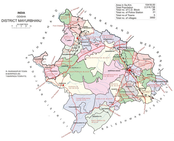
Mayurbhanj District Map
District Profile:
Mayurbhanj occupies a unique position being endowed with lush green vegetation, different fauna and rich cultural heritage. The district has a rich mineral base and is home to the Similipal Biosphere. This was a princely state until its merger with the state of Odisha on 1st January,1949. Since the date of its merger, Mayurbhanj has been organized and is administered as one of the districts of Odisha.
Iron-ore (hematite), vanadiferous and titaniferous magnetic, china clay, galena (lead ore), Kyanite, asbestos, steatite (soap stone) and quartzite constitute the principal mineral resources of Mayurbhanj district, of these the iron-ore deposits of Gorumahisani, Badampahar and Suleipat, which have been exploited for a period of about half a century, deserve special mention.
Atmashakti started its intervention in the district in November, 2016 with Jan Jagruti Mancha in 3 blocks with 10
| MAYURBHANJ DISTRICT PROFILE | |
| ADMINISTRATIVE SETUP | |
| Area | 10418.00 sq.km |
| Blocks | 26 |
| Tahasils | 26 |
| Gram Panchayat | 404 |
| Villages | 3698 |
| Rural/Urban Ratio | 92.34/7.66 |
| DEMOGRAPHY | |
| Population | 2,519,738 |
| Sex Ratio | 1,006 |
| Children (age 0 to 6 years) | 235824 |
| Average Family Size | 5 |
| No of Anganwadi’s Centre / Mini AWC’s | |
| No of Primary Health Centers | 82 |
| Infant Mortality Rate Per Thousand | 33 |
| Maternal Materiality rate Per Lakh | 170 |
| Literacy | 63.98 |
| ECONOMY | |
| HDI | 0.15 |
| GDP | |
| Per capita Income Rs | |
| Forest Cover | 4080.00 sq. km |
| Industrial Units | Iron, Steel, Agro industries, Flour Mills |
| Irrigated Area | 27043 Hect |
| Affected by Left Wing Extremism | Yes, medium |
| MGNREGA DATA (2020-21) | |
| No. of Families who got work | 19250 |
| Average No. of Days | 59.32 |